Above and below: Vitacura Aerodrome Runway 25 and the tiny control tower.
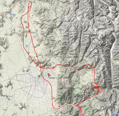
I took off from Runway 25 at Vitacura Aerodrome, then made a right turn heading northwest. After clearing some hills, I turned heading north, flying over the northern suburbs, the nearby copper plant, then along Highway 57 (Autopista Los Libertadores), which is the main expressway to Medoza, Argentina, on the east side of the mountains (see below for entire flight path).
 Above: My flight path.
Then I headed south/southeast, over a prison, poorer neighborhoods, some wealthy estates, NASA satellite ground station, past an army base, over the main cemetery, the metropolitan park, over my hotel in Las Condes, then continuing south over Providencia, Nunoa (past the Estadio Nacional), Macul, La Florida neighborhoods. Headed east into the Maipo River valley at about 4500ft, made a U-turn at San Jose de Maipo, then headed northeast over the Rio Colorado and climbed. Continued climbing past 7000ft, then did some ridge flying, crossing over the snow covered mountain ridge (approx. 8000ft) to the next valley north (of the Rio Molina), passing Valle Nevado ski resort, and then over La Parva resort. Headed southwest along the valley over the Rio Mapocho, descending back to 3500ft, and on final for Vitacura Aerodrome, and land on Rwy 25. Below is a map showing my flight path.
Above and below: Views immediately after takeoff from Rwy 25.
Above: At the commands during my first flight in Chile.
Above: middle/low income housing and a prison (top left).
Above: The highway leading to the Chacabuco Tunnel (road to Argentina).
Above: A military base surrounded by vineyards.
Above: This satellite ground station (the Centro de Estudios Espaciales) is a Santiago-based provider of space research services and was recently acquired by the state-owned Swedish Space Corporation.
Above: Plenty of vineyards surround the suburbs of Santiago.
Above: Flying over the Providencia and Las Condes neighborhoods of Santiago, including my hotel (top center). Jurgen told me that several times he had landed a helicopter on the hotel's rooftop helipad.
Above: An impressive view of eastern Santiago and the mountains taken with my fisheye camera lens.
 Above: An view of the mouth of the Maipo River Valley (taken with my fisheye camera lens).
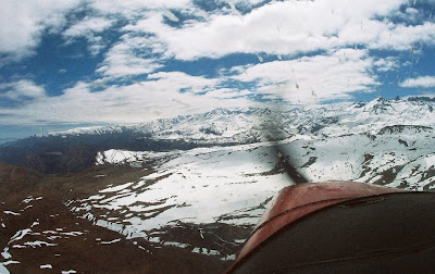
 Above: Clearing a ridge at about 7800 feet (it took several 360s to gain enough altitude because of a downdraft coming from the other valley). On the other side we reached the ski resort areas.
 Above: A short clip of the flight heading back to Santiago from the mountains.
After the flight, Jurgen and I relaxed and had a drink and empenadas at the club house of the Club de Planeadores de Santiago, the main operator of Vitacura Aerodrome. There were a few general aviation planes taking off and landing, but the majority of flights were gliders.
